I just cut my hair!! Short. The back is shaved even, but the front is long. It's cut at an angle along my jawline. I just decided to do this yesterday. Now I'm starting to think about it.
Pictures to come. I just need to load them onto the computer. This is a feat when in NC; I can't just plug it into my laptop & send it. It's about a 5 step process. Patience please. :-)
My summer has been great. I had some friends from AK visit. I went to the beach, then to the mountains to camp. I'm looking forward to visiting more friends & a slight 2-3 day backpacking trip next week.


11 July 2006


08 June 2006
Mendenhall Glacier
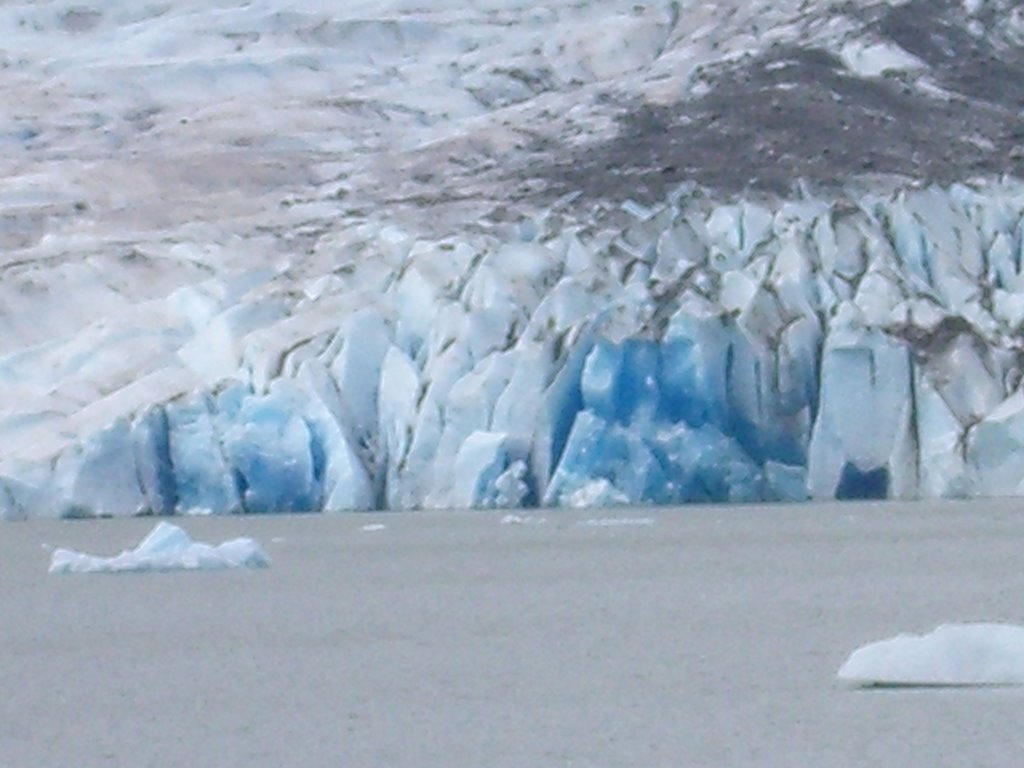
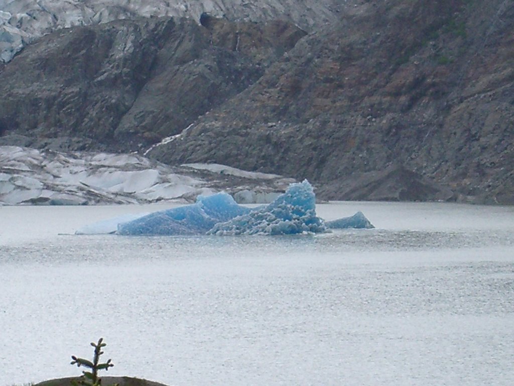
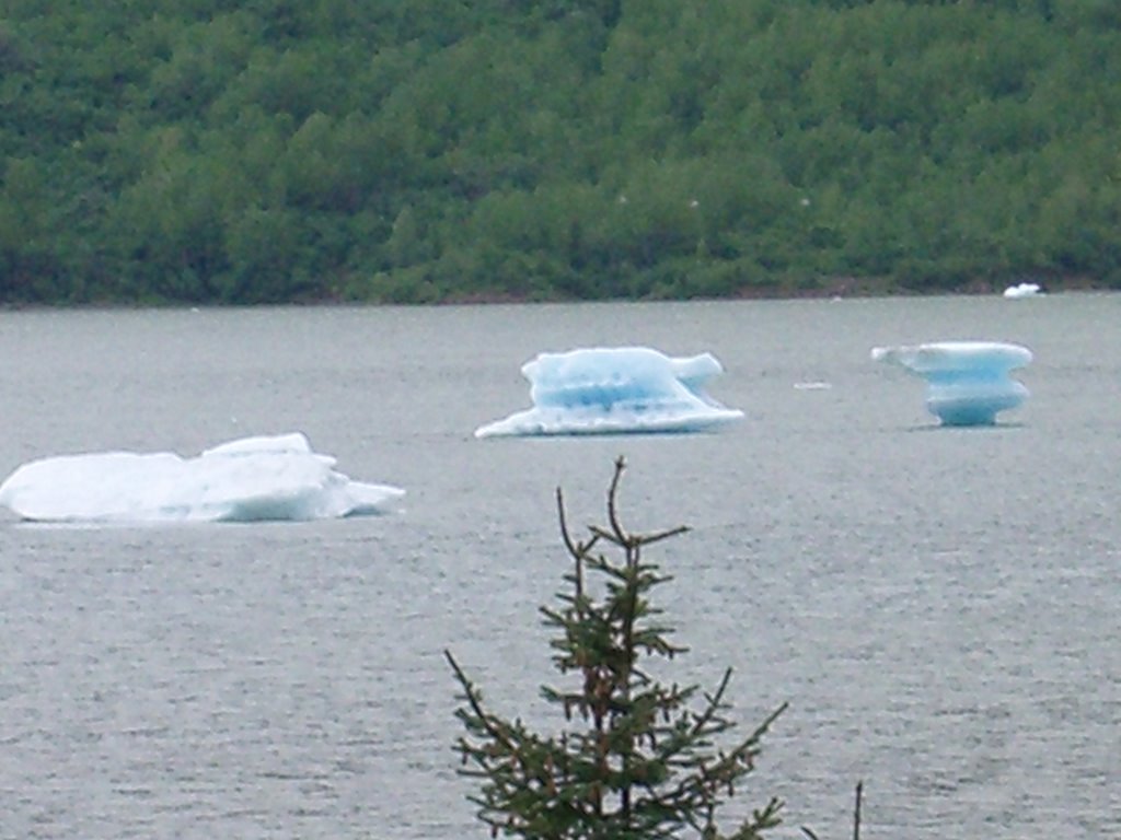

Juneau, Alaska
*"The drive up glacier." This glacier is enormous, easily accessable & georgous!
The huge chunk iceberg is seriously probably the size of a small bus.
06 June 2006
EDGE
I'm in Juneau & two days in for the EDGE workshop about GPS, GIS mapmaking program, & of course geology.
I'll tell more details later.
I'll tell more details later.
Don't let the Crow Pass you by
This hike has everything! I'm even thinking of it as an annual go around.
Day 1:
The first 3 miles up the mountain was almost entirely snow hiking. My poles helped me tremendously when I would sink to my knees or thighs. Let me back up, on the trek up the mountain to go over & around to Raven Glacier you have to hike on the side of a 45 degree slope, in the snow & on skeet (slick rocks). See the two little dots off center & above the tip of the triangle patch of grass? Those are two people in front of us.

At the top there is a waterfall, a great view, a lake (frozen when we were there) & a USFS cabin.
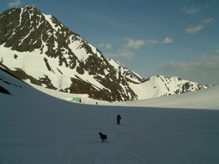
Raven Glacier is right on the edge of the Chugach National & State parks, in the National. Shortly after leaving the National park & walking on the other slope of the mountain we had some more fun. 150'-200' snow slides! Just sit down & stop before going over the ridge. We camped on this nice huge knol in the valley where 2 rivers fork. We had a good 5-6 tents for neighbors. It was tundra like & had a spongey, moss-like quality. It was cold being in wet socks & I melted snow for water. We had to boil to make sure we wouldn't get giardia (however it's spelled). Cold going to sleep, hot waking up. Trek started at 10:30am & ended at midnight (we took 5 hours worth of breaks though! Yikes)
Day 2: Slept late & didn't get to hiking until 3:00! Our first bit... Yes! Another 200' slide in the snow. Only Christina & I were sliding, the guys (Pops & Richard) walked down. At the rivers below the snow was 4'-5' stacked on top, open in some places, hidden in others. The current was very swift & one of the rivers is glacier fed, so it's coooold.
Raven Gorge is this Huge 100' dive down into a skinny maybe 6' wide crevis. It comes out of nowhere. First the swift moving river, then boom you could die. I saw a tree & a refrigerator size chunk of ice whirling about in one place. After crossing the bridge we had to climb up the snow 5' on the opposite side. Then, it was hiking over avalanches & bolders, through high bushes & mud (my least favorite part) singing for bears 'Hi bear.' We Had to make it to the Ford that night. We camped near the river & painstakingly hung our food for the night. We won't mention Pops & the throwing of tree branches & the *gasp* 'F' word.
Day 3:
Trek begain at 12:30...
The next morning Richard managed to find the trail to where we had to ford the river. There were a lot of moose tracks on the bank too. Did I mention that we were blessed with sunny days every day? This entailed a bit of sunburn, but that's alright (once you get past the putting the pack on part). So, the river wasn't too high at knees being the highest. But, being in the water burned my skin! I couldn't imagine what it was like for the guys we talked to the day before who crossed at midnight & it was at their thighs. Plus, there's a no fire ordinance right now. bbbbbrrrrrrrr....
That day was a lot of beach-side, flat path walking & forest trails. We did get to cross a log bridge with a rope & consequently have to harnass Bailey (Christina's dog) & have him swim across. He tried the log crossing thing, but it wasn't working out for him. Oh yeah, we saw a trail runner right there too. I wonder how deep in he ran. We were at about mile 14 from Girdwood at that point. Most of the hike that day followed alongside the river. We had a couple of crossings that were over rocks on the side of the sliff & there were ropes to hold onto. This was after a ladder climb up onto some rocks. It's also where Bailey needed to be harnessed & passed over the rock.
Christina took off her pack & it tumbled into the river about 30' down. Luckily her cooler caught on a tree branch & Pops had his makeshift repelling gear.

So, after the group effort to heave out the sopping wet & heavy pack, then ring out the wet stuffs, we made camp about a mile away at Twin falls. It was an early night setting up camp at 8:00, welcomed by some after two midnight endings.
Day 4:
To be continued ...
Day 1:
The first 3 miles up the mountain was almost entirely snow hiking. My poles helped me tremendously when I would sink to my knees or thighs. Let me back up, on the trek up the mountain to go over & around to Raven Glacier you have to hike on the side of a 45 degree slope, in the snow & on skeet (slick rocks). See the two little dots off center & above the tip of the triangle patch of grass? Those are two people in front of us.
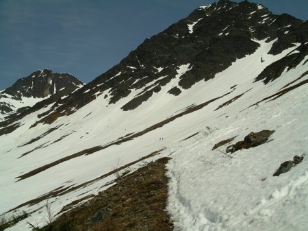
At the top there is a waterfall, a great view, a lake (frozen when we were there) & a USFS cabin.

Raven Glacier is right on the edge of the Chugach National & State parks, in the National. Shortly after leaving the National park & walking on the other slope of the mountain we had some more fun. 150'-200' snow slides! Just sit down & stop before going over the ridge. We camped on this nice huge knol in the valley where 2 rivers fork. We had a good 5-6 tents for neighbors. It was tundra like & had a spongey, moss-like quality. It was cold being in wet socks & I melted snow for water. We had to boil to make sure we wouldn't get giardia (however it's spelled). Cold going to sleep, hot waking up. Trek started at 10:30am & ended at midnight (we took 5 hours worth of breaks though! Yikes)
Day 2: Slept late & didn't get to hiking until 3:00! Our first bit... Yes! Another 200' slide in the snow. Only Christina & I were sliding, the guys (Pops & Richard) walked down. At the rivers below the snow was 4'-5' stacked on top, open in some places, hidden in others. The current was very swift & one of the rivers is glacier fed, so it's coooold.
Raven Gorge is this Huge 100' dive down into a skinny maybe 6' wide crevis. It comes out of nowhere. First the swift moving river, then boom you could die. I saw a tree & a refrigerator size chunk of ice whirling about in one place. After crossing the bridge we had to climb up the snow 5' on the opposite side. Then, it was hiking over avalanches & bolders, through high bushes & mud (my least favorite part) singing for bears 'Hi bear.' We Had to make it to the Ford that night. We camped near the river & painstakingly hung our food for the night. We won't mention Pops & the throwing of tree branches & the *gasp* 'F' word.
Day 3:
Trek begain at 12:30...
The next morning Richard managed to find the trail to where we had to ford the river. There were a lot of moose tracks on the bank too. Did I mention that we were blessed with sunny days every day? This entailed a bit of sunburn, but that's alright (once you get past the putting the pack on part). So, the river wasn't too high at knees being the highest. But, being in the water burned my skin! I couldn't imagine what it was like for the guys we talked to the day before who crossed at midnight & it was at their thighs. Plus, there's a no fire ordinance right now. bbbbbrrrrrrrr....
That day was a lot of beach-side, flat path walking & forest trails. We did get to cross a log bridge with a rope & consequently have to harnass Bailey (Christina's dog) & have him swim across. He tried the log crossing thing, but it wasn't working out for him. Oh yeah, we saw a trail runner right there too. I wonder how deep in he ran. We were at about mile 14 from Girdwood at that point. Most of the hike that day followed alongside the river. We had a couple of crossings that were over rocks on the side of the sliff & there were ropes to hold onto. This was after a ladder climb up onto some rocks. It's also where Bailey needed to be harnessed & passed over the rock.
Christina took off her pack & it tumbled into the river about 30' down. Luckily her cooler caught on a tree branch & Pops had his makeshift repelling gear.
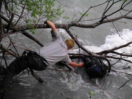
So, after the group effort to heave out the sopping wet & heavy pack, then ring out the wet stuffs, we made camp about a mile away at Twin falls. It was an early night setting up camp at 8:00, welcomed by some after two midnight endings.
Day 4:
To be continued ...
25 May 2006
Wuz uP wit me ...
I'm in Bethel for the night. We (my Pop & I) fly to Anchorage on the am jet (7:45am departure, ugh!).
Sat. we'll start our hike on Crow's Pass. Yay! We plan on camping & hiking leisurely. After the hike we have until June 3rd to piddle, yes I said piddle, around in ANC, Seward, & Homer.
June 3-12 Pops will join me in Juneau. On the 5th I start a field based geology class (EDGE) learning about GPS & a computer map making program; that ends on the 17th. We might meet up some during that time, but he's going to be exploring the area.
June 18th I'll go to Cordova, AK (Prince William Sound, Copper River area) to take another field based class. I guess we'll leave promptly on the 19th to go to mile 25 & settle into camp. This class deals with oceanography, ecology, & wetlands study. All going back to how we can use this in the classroom.
June 23rd, I'm homeward bound to NC. I haven't been there since August of last year!
August 7th I'll be homeward bound again for AK & my 4th year teaching! Woah...
For those of you who are non-Alaskans, it's 11pm & fully bright outside.
The midnight sun has begun!
Sat. we'll start our hike on Crow's Pass. Yay! We plan on camping & hiking leisurely. After the hike we have until June 3rd to piddle, yes I said piddle, around in ANC, Seward, & Homer.
June 3-12 Pops will join me in Juneau. On the 5th I start a field based geology class (EDGE) learning about GPS & a computer map making program; that ends on the 17th. We might meet up some during that time, but he's going to be exploring the area.
June 18th I'll go to Cordova, AK (Prince William Sound, Copper River area) to take another field based class. I guess we'll leave promptly on the 19th to go to mile 25 & settle into camp. This class deals with oceanography, ecology, & wetlands study. All going back to how we can use this in the classroom.
June 23rd, I'm homeward bound to NC. I haven't been there since August of last year!
August 7th I'll be homeward bound again for AK & my 4th year teaching! Woah...
For those of you who are non-Alaskans, it's 11pm & fully bright outside.
The midnight sun has begun!
Subscribe to:
Posts (Atom)